News
#DroneSurveying – The latest tool in the surveyor’s box
James Clarke, our Senior Land Surveyor provides some thoughts on the latest tool in the surveyor’s box.
“Over the last 5 years a rapid development in drone surveying technology has allow for cheaper, faster, easier to use equipment and software to reach surveyor’s arsenal. However, with all new technology, there are drawbacks.”
Here are some of the benefits and limitations of using drone surveys:-
#Benefits:
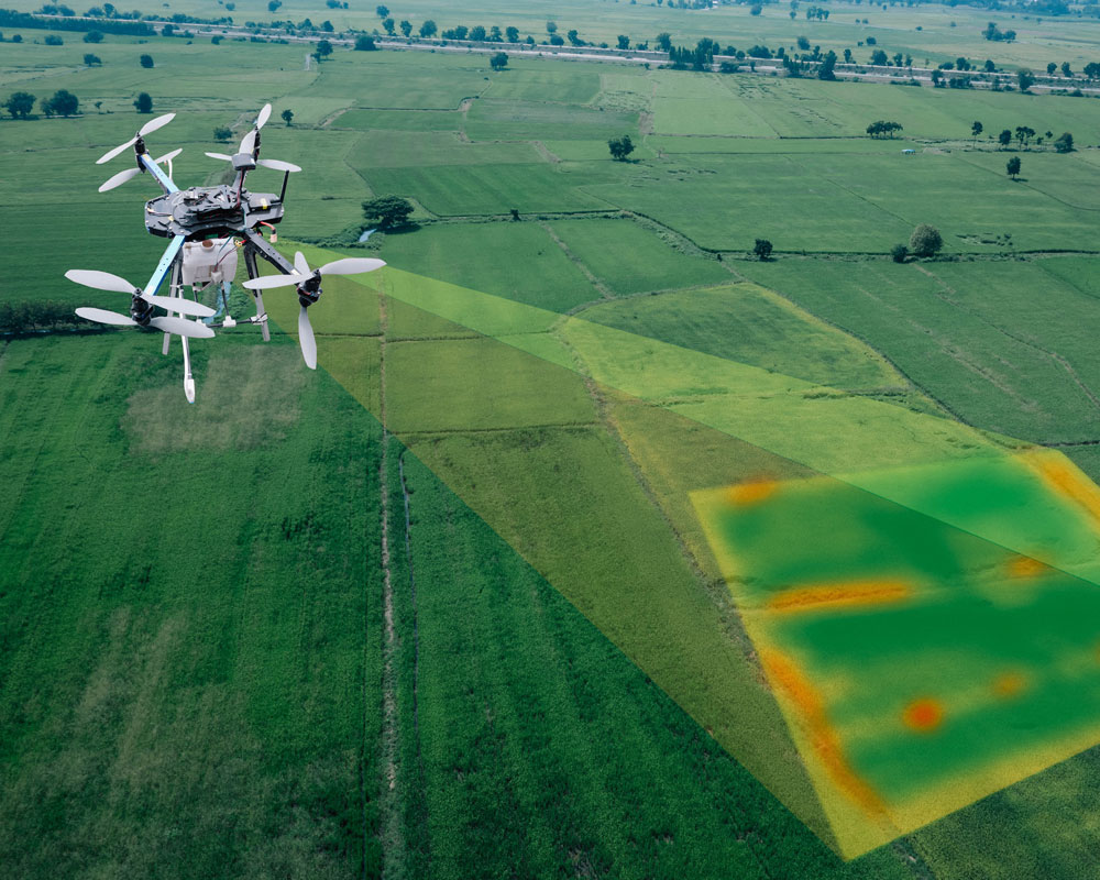
“A drone survey can cover a much greater area a lot faster than ground based surveying.
It can measure inaccessible areas that have physical limitations (roofs) or safety limitations.
Depending on the flight path/height and the sensors equipped a variety of resolutions can be recorded, dependent on the clients need for level of detail.
The data recorded is both useful and also visually pleasing, which can be a bonus for showing clients or posting online.
Combining drone data with a terrestrial survey allows buildings to be completely surveyed/modelled.”
#Limitations:
“Although the cost of drones will give you more ‘bang for buck’ than a few years ago, it can be expensive to get up and running, once the initial cost of buying/hiring the hardware and software and the necessary training and licenses have been paid for.
Unlike some of the newest terrestrial laser scanners, which are almost ‘plugin and play’, drone surveying can be very technical for beginners.
Depending on the subject, the data and the post processing can be data heavy, adding additional time.
There are a lot of restrictions and regulations stipulating where/when/ how close/ how high you can fly, which may cause some issues with data capture.
All commercial drone flying is monitored by the Civil Aviation Authority, so it isn’t something that anyone can just do quickly without going through the necessary steps.
Finally, the weather conditions on the day of survey will have a much greater impact than with traditional ground based surveying techniques.”

#Summary:
“To conclude, drone surveys will play a greater and more important role in data aquistion for surveyors in the next few years. With every new drone being released the technology is improving and becoming more affordable. The data offers a unique view that is often difficult or impossible to capture using traditional methods. However, it needs well trained operators or serious issues may arise.
Over the next few years it will be exciting to see what this new technology will present, and what potential developments it may lead to.”

For more information about this article or a competitive proposal for a drone survey please do contact one of our account managers [email protected]